previous– Temse (Norway) –next
| Lake name: | Temse | Country: | Norway | GIG Region: | N |
|---|---|---|---|---|---|
| GIG Type: | LN2a | Lake code: | 019-10951-L | Altitude(m a.s.l.): | 15 |
| Area (km2): | 0.6 | Mean depth (m): | 5 | Mixing regime: | Stratified |
| Alkalinity (m eq/l): | 0.2 | Retention time (yr): | 0.6 | Chlorophyll a (µg/l): | 18 |
| Total phosphorus (µg/l): | 16 | Eutrophication status: | 3 - Medium | Hydromorphological status: | 1 - Low |
Description
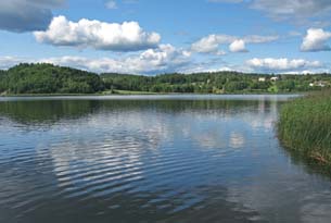
Temse is situated close to the coastline, 15 m above sea level, in the southern part of Norway. The lake has a surface area of 0.6 km2, and is fairly shallow with a maximum depth of 10 m and a mean depth of 5 m. The catchment area comprises agricultural land and forest, and the lake is mesotrophic to eutrophic with a significant proportion of cyanobacteria. The lake has a recreational value for the local population, mostly ornithologists and for fishing. Dense helophyte vegetation dominates littoral, most Phragmites australis and to a lesser extends Schoenoplectus lacustris. The macrophytes in the lake are dominated by Fontinalis, Nymphea alba, Potamogeton perfoliatus and P. obtusifolius.
back to overview of all sampling sites