previous– Rostherne Mere (United Kingdom)
| Lake name: | Rostherne Mere | Country: | United Kingdom | GIG Region: | CB |
|---|---|---|---|---|---|
| GIG Type: | LCB1 | Lake code: | UK32650 | Altitude(m a.s.l.): | 27 |
| Area (km²): | 0.48 | Mean depth (m): | 13.6 | Mixing regime: | Stratified |
| Alkalinity (m eq/l): | 2.43 | Retention time (yr): | 1.1 - 3.4 | Chlorophyll a (µg/l): | 32.9 |
| Total phosphorus (µg/l): | 162.83 | Eutrophication status: | 3 - High | Hydromorphological status: | 1 - Low |
Description
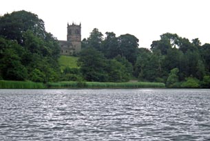
Rostherne Mere is a natural lake in a rural catchment and is scheduled as a National Nature Reserve largely for its winter waterfowl. It has a natural shore-line of dense reed-bed and woodland. It has long been eutrophic, with cyanobacterial blooms at the site recorded as far back as the 16th century and now established as a typical feature in the summer. The lake received sewage effluent from the 1930s until it was diverted in 1991.
Since 1990 it has been routinely monitored by the University of Liverpool, investigating lake recovery responses to nutrient loading reductions (See Carvalho L, Beklioglu M & Moss B, 1995. Changes in a deep lake following sewage diversion - a challenge to the orthodoxy of external phosphorus control as a restoration strategy? Freshwater Biology, 34, 399-410; Moss B, Barker T, Stephen D, Williams A, Balayla D, Beklioglu M & Carvalho L. 2005. Consequences of reduced nutrient loading on a lake system in a lowland catchment: deviations from the norm? Freshwater Biology, 50, 1687-1705.).
back to overview of all sampling sites